Sunday, March 28, 2010
Mt. Hood
Mike and Dennis starting up Mt. Hood going by the jumps at Timberline.
Our campsite and an awesome sunset behind Illumination Rock.
Dozens of climbers on the Hogsback and others traversing to the Old Crater Variation. There was a lot of falling ice on the mountain this weekend. Two climbers were seriously injured and many others had minor injuries. Dennis and I made it part way up the Hogsback when we saw a guy with a bloody face. He had been hit by ice. There was a definite need for speed if we were going to cross the shooting gallery. Dennis and a lot of other climbers called it good at the Hogsback. As I reached the traverse, I decided that I did not want to be trapped behind a bunch of slow moving climbers, so I opted for the Pearly Gates instead.
The Pearly Gates were not being used very much due to their steep, icy condition. I figured it was safer than spending 30 minutes in a shooting gallery. Everything went well until I stopped to take some pictures. Wouldn't you know it, I got smacked in the knee with a chunk of ice while I was taking pictures! I knew better.
I topped out, took some pictures and then turned to head down with the crowds. I discovered that while I was on the top, a guy had fallen off the traverse and tumbled 500'. He was seriously injured and had to be hauled off the mountain. Dennis had already broke camp and we had a nice descent in perfect snow.
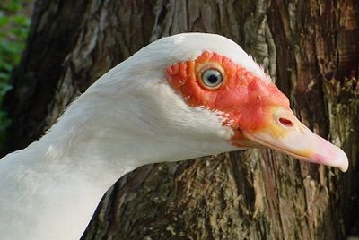
Unfit mother?
Everyone will tell you how prolific muscovies are. "If you have a pair, you'll soon have dozens," they'll say.
But this makes at least the third time that our gal has failed to hatch a single egg. (Not always her fault - Jasmine found and ate all the eggs once.)
This time she laid about ten of them, in the chicken coop. She sat on them all night, wandered around off the nest most of the day, and then finally abandoned them after a week or so.
Saturday, March 27, 2010
Dynamite M6 First Ascent
Putting work into Dynamite M6 |
Recently I wrote about a mixed climb that I had top roped last season. It was a fun line that I thought was worth investing some time and effort into. In recent days I spent some time equipping the route and giving it a few tries with State College climber and friend Joel Torretti. Early season and tired arms shut me down several times. With a night of rest I managed to get it. This new climb at Irishtown crag in Dunbar is now officially named Dynamite and is roughly M6. Yesterday my faithful partner Laura accompanied me to video, belay and motivate me for the send. With several days pump and some sheer determination I sent. I decided to put a short clip together to show everyone the climb. I hope this motivates more folks to come join in the great winter climbing that Southwestern PA has to offer. This is my first ever attempt at doing any video work, so any feedback is appreciated. click here and enjoy the clip!
My newly created helmet art |
Tomorrowshould be an incredible day. Its Laura and myfirst day back at the local big ice playground. Laura and I are so excited to get our first pure ice day in (maybe). Rumor has it thatice climbing hardmanand old buddy Chip Kamin will be joining us for some tool swinging at some of the biggest local ice he's ever climbed. Dr. Bob, Regina, Felipe, Laura and myself are planning for some big fun on the best looking early season ice in 10 years.Of note, last yearI witnessedan incredible mixed lineform that I hadn't seen in otheryears. If its in tomorrow, I think I may have to investigate. Stay tuned for the details!
Projected corner line (last season) - Ohhhh, Ahhhhhhhh! |
Monday, March 22, 2010
Winter Moonlight on the Pigeon River
Thanks to unfavorable photography conditions for most of the past week (nothing but gray skies and flat light), I've been searching through my archives once again looking for images that I've wanted to put on my website but hadn't for one reason or another. This shot was taken at 3:17 AM on January 1, 2007 - only a few hours into the new year! The moonlight on that night was spectacular, and I had spent almost the entire night out in the woods with my camera. This photo was made with my old Canon EOS 20D camera with an exposure time of 20 seconds at an aperture of f4.0 and an ISO of 800. I hope to have some nights like this over the coming winter!
Saturday, March 20, 2010
No mow
Oxeye daisies and clover
The advantages of (1) not using weedkillers, and (2) not being able to mow for a while.
Hubby is outside mowing it all down as I type. While I sit inside and "play blog," as he says. I saved several of the daisies for a vase though.
Evening primroses and more clover.
The primroses are mostly pink in real life, but the camera has a hard time picking it up.
As far as I can tell "evening" primroses are actually open 24 hours a day. But I haven't gotten up at 3am to check that.
Wednesday, March 17, 2010
Sunday, March 14, 2010
Grandpa Vic and Some Grandkids
A couple years ago, my uncle Bill Phend, sent a few photos he had scanned. Finally found where I'd put them on my hard drive. . . this is the only one that had Grandpa with us kids. Taken in August of 1949 at the home of my Aunt Phyllis in Columbia City. Looks like Grandpa and Kathy are the only ones enjoying themselves! That's me in front, cousin Tom, brother Doug (behind me), cousins Mike and Kathy, and Grandpa trying to keep us all in one spot.
Wednesday, March 10, 2010
Smoothies All Around!
No sooner had I returned from New York over the weekend, than the Soma Smothie I'd been anticipating for review had arrived. So I took a break from the loop frame delirium of the New Amsterdam Bicycle Show and immediately took it for a spin. Soma roadbikes are not very common here on the East Coast. So imagine my surprise when on my way home I encountered another Smoothie!
As I stopped to snap some pictures at the end of my ride, these gentlemen recognised me and we had a nice chat about their 650B conversions - one a vintage Andre Bertin and the other a Soma Smoothie ES with a Bontrager fork. I am so happy to be back home! Where else but in Boston does one encounter this sort of thing?
But enough about other people's bikes for now, and here is more about the one I am riding. This Soma Smoothie is on loan for review directly from the manufacturer. It is a 52cm steel frameset that was built up to accommodate my Campagnolo lever preferences, which was very nice of them. Everything shown on the bike is directly from Soma, except for my bag and pedals.
I have not weighed the bike yet, but (without saddlebag) it feels pretty similar to my vintage Moser - so I'd say around 21lb.Described as a road/race frame, the Smoothie nonetheless has eyelets for fenders and clearances for 28mm tires.
One thing it does't have? Toe overlap! That's right: Here is a stock 52cm road/racing bike with no TCO. They exist. I wear size 37-38 shoes and with 23mm tires there is a boatload of clearance (well maybe it's a small boat, but still). I can definitely fit it with 25mms without a problem, maybe even 28mm.
The pearly white colourscheme is adaptable to a wide range of aesthetics, from classic to colourful to stark. The TIG welded frame will not satisfy lug lovers but is solid and smooth-jointed. It is a versatile, unobtrusive frameset. A carbon fork is available in place of the standard steel one for those wishing to go that route.
This is not a review, so I won't go over the details of the build at this stage. But as far as first impressions (and mind you this is after just 25 miles), a couple of things stand out: First, it is smooth - as advertised. And I am talking about ride quality: very comfy over bumps and I do not feel any road vibration. And second, it handles tamely and predictably. No twitchiness and very precise cornering at the moderate speeds maintained during my conservative "shake down" ride.
The Smothie ES owner I met on the road is very happy with his bicycle, which he's got outfitted with 32mm tires and fenders. I will refrain from writing more about the bike I have on loan until I ride it extensively, but at under $400 for the frame, I am impressed so far. We need more of these on the East Coast and I hope some local shops will carry floor models in the near future.
Sunday, March 7, 2010
Fireweed Sunset
I was driving through a logging cut when I saw this nice patch of fireweed. I only had to wait about 10 minutes for the sun to drop to the horizon in order to make this image.
It's Looking Better...
One day this past week was spent at the Allen County Public Library attempting to determine the validity of the statement made in an article by Carrie Bray in 1949 that her great-grandfather (my 3rd great-grandfather) John Bray had arrived in Indiana on March 5, 1816.
An affidavit by Daniel Bray in the Revolutionary War pension file of his father John Bray, stated that “Some time in the early part of the year 1816, he went to the land office of Cincinnati to enter the North East quarter of Section No 25, town No 2, range 3 West. That owing to some mistake in the land office he could not effect an entry and he was obliged to return home and that his father John Bray, then went to the office and entered the said quarter...”
So the “problem” was: When was the land actually purchased and why did Daniel state that it was in Range 3?
The book “Indiana Land Entries Volume I” by Margaret R. Waters, published in 1948, contains the records for Indiana that are from the Cincinnati Land Office. It covers the area known as the “wedge” in the southeast corner of the state.
The map above shows the status of the Indiana Territory in 1810 with the four counties in existence at the time: of Knox (Kn), Harrison (Har), Clark (Clk), and Dearborn (Dea). The “wedge” mentioned in the Waters book was the area known as Dearborn county in 1810 as well as neighboring portions of Clark County.
By 1814 there were a few more counties in the Indiana Territory. Franklin and Wayne counties were created in 1811 while Switzerland was created in 1814 from that Dearborn “wedge” area as well as from portions of other counties. The two maps above are from the Genealogy Inc. website.
In the introduction of her book, Margaret R. Waters states that the records were copied solely for genealogical purposes to enable a searcher to learn if an ancestor located in Indiana and if so, where and when. To save time and space the acreage and final certificate numbers were omitted. A minimum amount of information is given (name, property description, date of entry) but enough to determine if the person of interest entered land in what would become the state of Indiana.
At the top of page 79 was the entry for John Bray showing that he entered the “NE 1/4 of S25 on 3-5-1816”. The line just below John, includes the name of Edward Ray who may be the same person who married Jane Bray, daughter of John. The previous page (78) showed that the land was in Switzerland County in T2N, R4W of the 1st PM (Township 2 North, Range 4 West of the 1st Principal Meridian).
The map above (from the Waters book) shows the “wedge” area of land from the Cincinnati Land Office included in the book “Indiana Land Entries Volume I”.
This enlarged portion of the previous map shows the townships that comprise Switzerland County. The dotted lines show the boundaries of Switzerland and Ohio Counties. (Ohio County was created in 1844 from Dearborn.) The land that John Bray purchased was in T2N R4W, which is in that tiny red triangle bordering Range 3 West.
Portion of a Switzerland County Map from the My Indiana Home website showing the location of Braytown in Craig Township.
Luckily for me, the Allen County Public Library has a series of microfilms called “Ohio Land Records” which includes the records of the Cincinnati Land Office. Film OLR-110 contained “Cincinnati Land Office Entries, 1814-1829” and it was even indexed by page number. Most of the page numbers were missing or illegible but it didn't take long to find his entry since I had the date he entered the land.
Cropped portion of the page showing the entry for John Bray (last entry on the image). The date at the top shows the transaction was made on March 5th 1816. The text in the column on the right states “John Bray of Franklin County applied to enter the North East quarter of Section 25 Town 2 Range 4 West - Containing 159 44/100 acres and produces the Receiver's Receipt No 30668 dated this day for $79 72/100 amt [?] being the one fourth part of the purchase money of said quarter Section of Land.”
So it seems that the date of March 5, 1816 as given by Carrie Bray in her 1949 article correlates to the date of purchase of the land. It also confirms the statement made by Daniel Bray in his affidavit that he went to the land office in Cincinnati “some time in the early part of the year 1816”.
But there was a surprise in the land entry document - the statement that John Bray was “of Franklin County”.
In searching the web for information, I came across the site Cincinnati Land Office Records, which appears to be a part of the Ohio Memory project even though those records are not included in their list of collections. The site contains images of the original land patents issued to the purchasers. There are only a little over 300 documents currently online but it is going to be an awesome site when they get more documents published. Anyway, at the bottom of the second paragraph of “About this collection” it states
So that might present a little problem. However, Franklin County, Indiana is so very close to Switzerland County while Franklin County, Ohio is further north and east, closer to the central part of Ohio. Since we don't know the whereabouts of John Bray between 1805 and 1816 (as mentioned in The Evidence at Hand) it is possible that he could have ventured further north, but I don't think so. Perhaps that is just wishful thinking on my part. If he was “of Franklin County, Indiana Territory” then that would be evidence that he was actually residing in the area and would definitely be eligible for membership in the Territorial Guard Society of Indiana.
We have the record of the land entry on March 5, 1816 and the statement by Daniel Bray that he, then his father John, went to the Cincinnati Land Office in the early part of 1816. Does that constitute enough evidence to be able to say that they were then residing in the Indiana Territory?
What other records exist during that time period that can be used to help substantiate the claim that John Bray resided in the Indiana Territory in 1816?
An affidavit by Daniel Bray in the Revolutionary War pension file of his father John Bray, stated that “Some time in the early part of the year 1816, he went to the land office of Cincinnati to enter the North East quarter of Section No 25, town No 2, range 3 West. That owing to some mistake in the land office he could not effect an entry and he was obliged to return home and that his father John Bray, then went to the office and entered the said quarter...”
So the “problem” was: When was the land actually purchased and why did Daniel state that it was in Range 3?
The book “Indiana Land Entries Volume I” by Margaret R. Waters, published in 1948, contains the records for Indiana that are from the Cincinnati Land Office. It covers the area known as the “wedge” in the southeast corner of the state.
The map above shows the status of the Indiana Territory in 1810 with the four counties in existence at the time: of Knox (Kn), Harrison (Har), Clark (Clk), and Dearborn (Dea). The “wedge” mentioned in the Waters book was the area known as Dearborn county in 1810 as well as neighboring portions of Clark County.
By 1814 there were a few more counties in the Indiana Territory. Franklin and Wayne counties were created in 1811 while Switzerland was created in 1814 from that Dearborn “wedge” area as well as from portions of other counties. The two maps above are from the Genealogy Inc. website.
In the introduction of her book, Margaret R. Waters states that the records were copied solely for genealogical purposes to enable a searcher to learn if an ancestor located in Indiana and if so, where and when. To save time and space the acreage and final certificate numbers were omitted. A minimum amount of information is given (name, property description, date of entry) but enough to determine if the person of interest entered land in what would become the state of Indiana.
At the top of page 79 was the entry for John Bray showing that he entered the “NE 1/4 of S25 on 3-5-1816”. The line just below John, includes the name of Edward Ray who may be the same person who married Jane Bray, daughter of John. The previous page (78) showed that the land was in Switzerland County in T2N, R4W of the 1st PM (Township 2 North, Range 4 West of the 1st Principal Meridian).
The map above (from the Waters book) shows the “wedge” area of land from the Cincinnati Land Office included in the book “Indiana Land Entries Volume I”.
This enlarged portion of the previous map shows the townships that comprise Switzerland County. The dotted lines show the boundaries of Switzerland and Ohio Counties. (Ohio County was created in 1844 from Dearborn.) The land that John Bray purchased was in T2N R4W, which is in that tiny red triangle bordering Range 3 West.
Portion of a Switzerland County Map from the My Indiana Home website showing the location of Braytown in Craig Township.
Luckily for me, the Allen County Public Library has a series of microfilms called “Ohio Land Records” which includes the records of the Cincinnati Land Office. Film OLR-110 contained “Cincinnati Land Office Entries, 1814-1829” and it was even indexed by page number. Most of the page numbers were missing or illegible but it didn't take long to find his entry since I had the date he entered the land.
Cropped portion of the page showing the entry for John Bray (last entry on the image). The date at the top shows the transaction was made on March 5th 1816. The text in the column on the right states “John Bray of Franklin County applied to enter the North East quarter of Section 25 Town 2 Range 4 West - Containing 159 44/100 acres and produces the Receiver's Receipt No 30668 dated this day for $79 72/100 amt [?] being the one fourth part of the purchase money of said quarter Section of Land.”
So it seems that the date of March 5, 1816 as given by Carrie Bray in her 1949 article correlates to the date of purchase of the land. It also confirms the statement made by Daniel Bray in his affidavit that he went to the land office in Cincinnati “some time in the early part of the year 1816”.
But there was a surprise in the land entry document - the statement that John Bray was “of Franklin County”.
In searching the web for information, I came across the site Cincinnati Land Office Records, which appears to be a part of the Ohio Memory project even though those records are not included in their list of collections. The site contains images of the original land patents issued to the purchasers. There are only a little over 300 documents currently online but it is going to be an awesome site when they get more documents published. Anyway, at the bottom of the second paragraph of “About this collection” it states
“In certain instances it has been impossible to determine the correct state of origin of the purchaser; generally this is due to the fact that both Indiana and Ohio have identically-named counties, such as Franklin County. In these cases, both Ohio and Indiana have been listed as the state of origin.”
So that might present a little problem. However, Franklin County, Indiana is so very close to Switzerland County while Franklin County, Ohio is further north and east, closer to the central part of Ohio. Since we don't know the whereabouts of John Bray between 1805 and 1816 (as mentioned in The Evidence at Hand) it is possible that he could have ventured further north, but I don't think so. Perhaps that is just wishful thinking on my part. If he was “of Franklin County, Indiana Territory” then that would be evidence that he was actually residing in the area and would definitely be eligible for membership in the Territorial Guard Society of Indiana.
We have the record of the land entry on March 5, 1816 and the statement by Daniel Bray that he, then his father John, went to the Cincinnati Land Office in the early part of 1816. Does that constitute enough evidence to be able to say that they were then residing in the Indiana Territory?
What other records exist during that time period that can be used to help substantiate the claim that John Bray resided in the Indiana Territory in 1816?
Saturday, March 6, 2010
Early Winter Wonderland on the Arrowhead Trail
More than a foot of snow already blankets the landscape along the Arrowhead Trail in Northeast Minnesota on November 23, .
Wednesday, March 3, 2010
Vantage The Feathers ..
Joined Ken, Sabrina and others to lend a hand with an "intro to rock climbing" seminar. Against the advice I normally give of not going to the desert in the summer, we went out to Vantage. We climbed at the Feathers on the north side, so we were not in direct sun. Temps remained moderate and climbing was enjoyable. The novices seemed to have fun, and I as a leader had a good time and got to climb plenty. Learned how to self-belay with a GriGri as well. Finally climbed the Beckey Route (5.7) there as well. In the early afternoon we had enough climbing and drove down to the Columbia for a swim.
The Feathers.
High desert.
Columbia River boat ramp.
The Feathers.
High desert.
Columbia River boat ramp.
Monday, March 1, 2010
Conditions after the rains look good
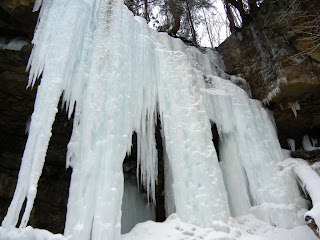
Most "local" ice climbers are figuring that the season has just ended with all the rain. What ice could be left? I'm happy to report the the community that most held in with minor damage. Here's a photo conditions report from today. Hope this motivates you to come check out SWPA!
Other local ice conditions...
So there it is. There's still lots of ice in most areas. The forecast looks promising for improving conditions. Now is the time to climb. The ice has finally become smooth and good sticks are easier now than in weeks past. Get out and enjoy the great conditions we've been given. If you have any questions about other local conditions or areas, drop me a line. Hope to see you out there. -Tim
Irishtown, The Prow WI4, M3 a little washed, watch the top. |
Irishtown, Mouth of Madness WI5- in slightly easier conditions. The best its looked this season |
Irishtown, Dynamite M6+, almost a drytool line. Not much ice at the top. |
Irishtown, Pale Wildwood Ice Tower WI4 makes another appearance |
Irishtown, Dirty-T M4 is in great shape for a moderate mixed |
Irishtown, Upper Wall, currently OUT Possibly by next weekend it will rebond. |
Upper Meadow Run, Ohiopyle State Park, School Yard WI4- to 3- held up and is in great shape. |
Upper Meadow Run Amphitheater is looking good. |
Upper Meadow Run, Ohiopyle State Park, Buckey's Line WI3+ This rare former is in good shape. Watch the thick top out. |
Lower Meadow Run, Season Finale M6 R is ready |
Lower Meadow Run, Ohiopyle State Park, Main Flow WI3, Anger Management M6 climbs up through the daggers, currently in great shape. |
Lower Meadow Run, Caveman M7 the ice is a little short, but should go |
Lower Meadow Run, The Flows WI2 still nice and thick |
Other local ice conditions...
The Beast WI5+/6 formed more right due to wind. Its tentacles are about grounded. Son of Beast WI5+ filled in nicely. |
The Infinite WI5+ and The SICK-le WI6, M7 |
Still plenty of ice and new lines to be climbed... |
Subscribe to:
Posts (Atom)